From the Netherlands to Japan, governments are harnessing advanced technology to revolutionise and improve rainfall management at a systems-level. Britain should do the same.
We are entering a new era of water volatility – from prolonged droughts straining reservoirs to increasingly destructive floods submerging infrastructure. And this more extreme climate is reshaping how we plan, build, and protect our environments. And as the environment around us becomes more unpredictable, there has never been more need for accurate, real-time, and contextualised geospatial data.
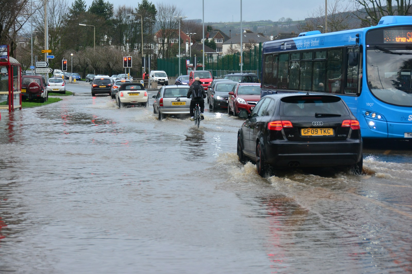
Sandbags alone can’t save us from flooding. Data can underpin resilience. The mapping of rivers, lakes, canals, and coasts is integral to understanding the way water behaves, especially in a shifting climate. Flood analysts, civil engineers, architects, utility companies, and more can all benefit from detailed hydrographic surveys – analysing water volatility as it stands today and preparing for an uncertain future.
Floods are among the most financially damaging natural disasters in the UK. The winter floods in 2015 and 2016, driven by Storm Desmond and Storm Eva, cost the economy an estimated £1.6billion. Local authorities bore the brunt of infrastructure damage, and homeowners and insurers shouldered the costly repairs.

With the cost-of-living rising year-on-year, communities can’t afford to take chances. It’s more important than ever that councils are supported with the right data to enable targeted, effective, and justifiable interventions before the next crisis hits. By deepening our understanding of the data behind the UK’s waterways, we can collectively strengthen resilience.

Other countries have shown what’s possible when flood resilience is treated as a systems-level challenge. In The Netherlands — where over 50% of the population lives below sea level — the government has pioneered the use of digital twins for its flood infrastructure, leveraging continuous hydrographic and topographic surveying to model and predict risk scenarios.
Similarly, Japan integrates real-time LIDAR and sonar data into its early-warning systems, enabling authorities to adapt water management in near real-time during typhoons or tsunami events.
Actionable geospatial intelligence can bring this same level of sophistication to the UK and Ireland. Through high-resolution hydrographic surveys, we can support flood resilience by providing knowledge of how lakes, rivers, and coasts behave, preparing for crises long before they happen.
The importance of a full picture
In County Kildare, Ireland, Murphy Geospatial partnered with the local government to help protect the community from flood risks. A comprehensive hydrographic survey was carried out across local waterways and the surrounding infrastructure. The precise geospatial data gathered through topographic and hydrographic surveys played a key role in advancing the Athy Flood Relief Scheme.
The data collected was used to build accurate digital terrain and surface models, enabling the Athy Flood Relief Scheme to review various flood scenarios under different rainfall and flow conditions. This helped them to identify vulnerable areas and assess the effectiveness of possible mitigation measures. By uncovering risks, such as previously unknown culverts discharging water into channels, the team provided high-quality, accurate data essential for the effective planning, design, and management of future flood defence infrastructure.
Close collaboration with local communities was central to the project’s success. Threshold levels were recorded at over 1,000 properties, and detailed surveys were carried out on flood defences, lock gates, bridges, and more – ensuring a complete and reliable picture to guide the scheme’s development.

Understanding the cause enhances the effect
Climate change is intensifying both the frequency and severity of extreme rainfall. According to the UK Met Office, the country has become 7% wetter over the last 30 years, with the frequency of extreme daily rainfall increasing.
Rising sea levels further compound the risk for tidal rivers and low-lying coastal towns. Flooding is now a predictable consequence of a warming planet and demands a proactive, data-led solution process.
The science behind flooding is far more complex than a volume of water exceeding the environment’s capacity to absorb or move it. From catchment saturation caused by previous rainfall — which limits the ground’s ability to absorb new water — to the morphology of rivers and channels, where natural or engineered constrictions slow the movement of water, flooding is shaped by a range of interconnected factors.
Each flood cause is entirely unique to the location where it occurs. In urban areas, impermeable surfaces accelerate runoff, placing strain on drainage systems that were not built for intense rainfall. The failure of a single piece of infrastructure can quickly escalate localised flooding, but this is preventable, with each flood driver being spatial, dynamic, and measurable with the right tools.
Securing resilience in a changing world
As flooding becomes more frequent and complex, local authorities, developers, and governance should be focused on unlocking the full potential of geospatial certainty for planning, design, construction, and long-term resilience. Climate volatility is already here, and as the UK confronts deeper droughts and more damaging floods, clarity and security can be achieved through precise and comprehensive data.
Tim Faulkner, Head of Department at Murphy Geospatial, a specialist company in capturing, collating, verifying and governing geospatial data to improve effectiveness and efficiencies.
Images: Top – Chris Gallagher via Unsplash / Middle & Bottom: Murphy Geospatial
More Case Studies, Features and Industry Insight:
How BMW tackled rural EV charging with National Parks guidance
The evolution of urban green spaces for people and planet
PlantSea plastic-free film is a water-soluble game-changer